
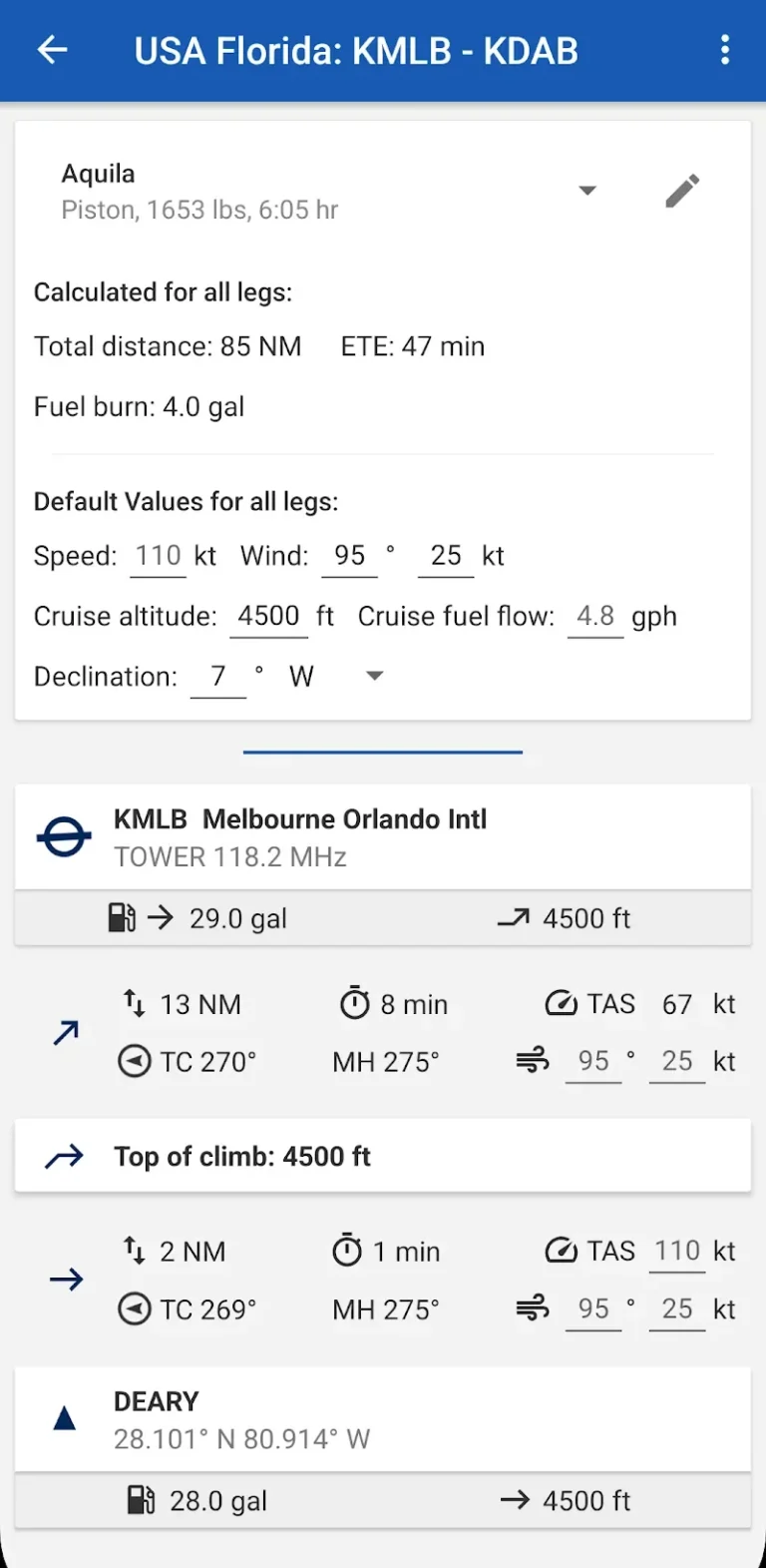
Flying enthusiasts finally have a proper aviation mapping solution with Avia Maps, which brings professional-grade flight planning tools to your mobile device. This comprehensive aviation app transforms complex flight preparation into a streamlined process that works both on the ground and in the air. The interface feels purposefully designed for pilots who need quick access to critical information without unnecessary bells and whistles.
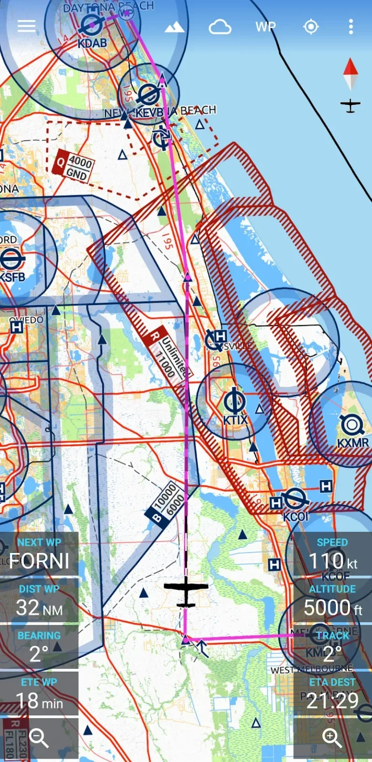
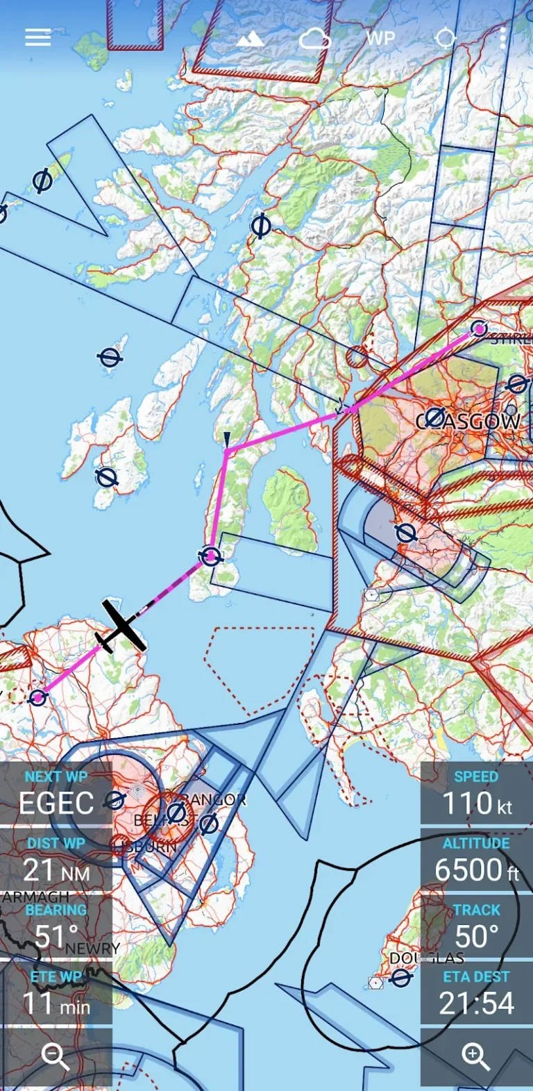
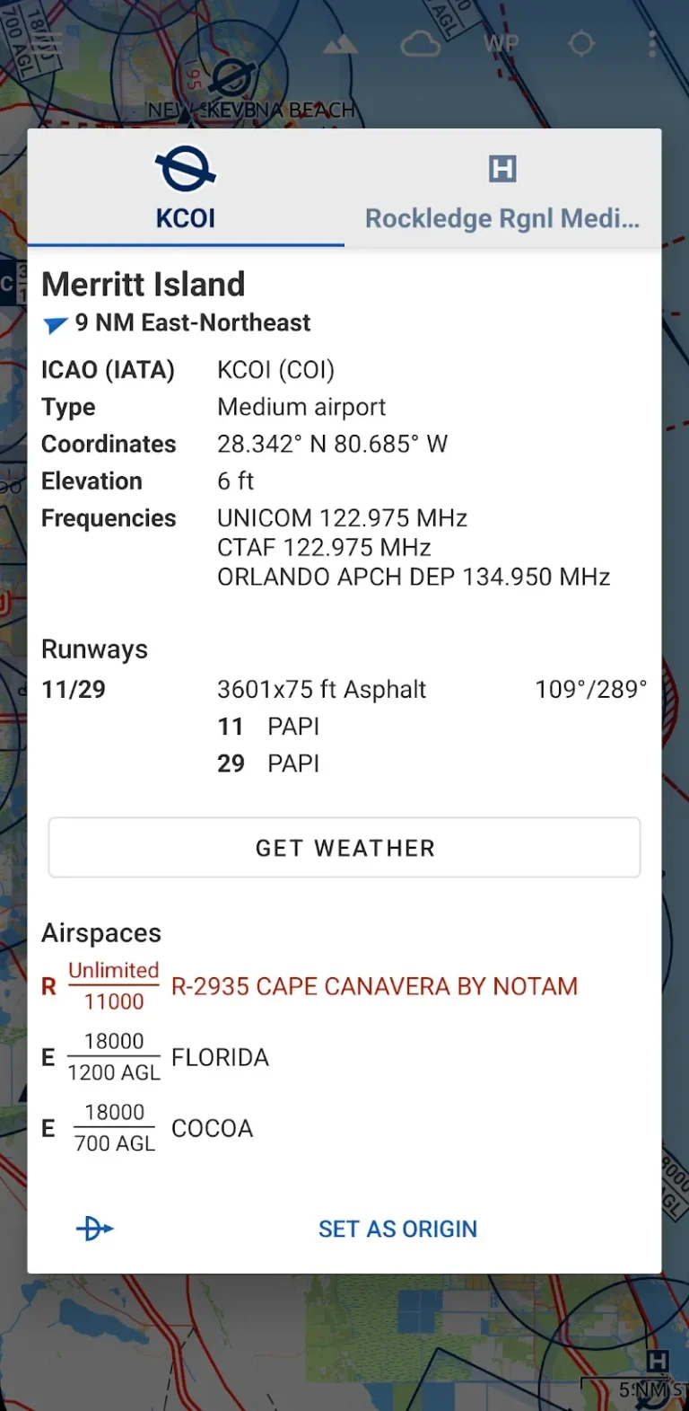
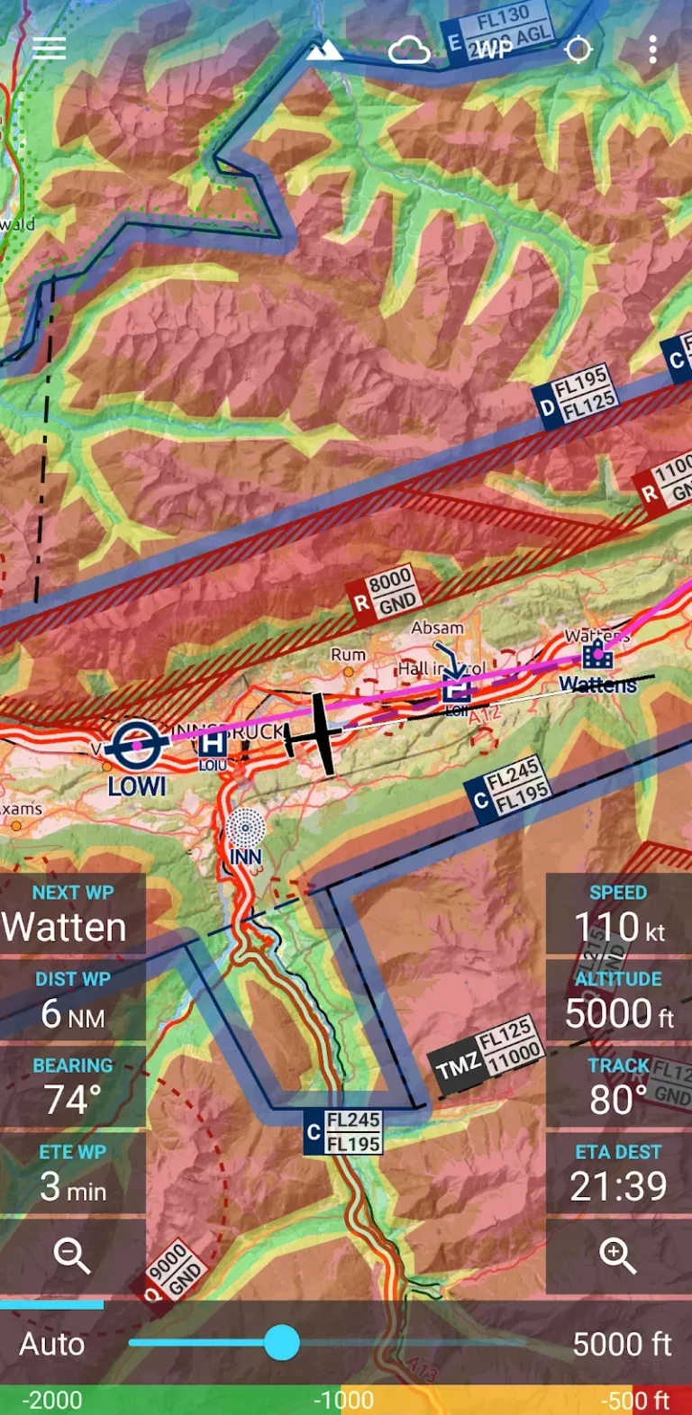
The app covers an impressive scope with over 65,000 airports, 9,000 navigation aids, and 15,000 waypoints spanning the globe. You can download detailed 5×5 degree sections for offline use, which proves invaluable when you’re flying through areas with spotty cell coverage. The airspace data covers 62 countries across most continents, though the selection feels somewhat limited for pilots operating in less common regions.
Weather Data That Actually Matters in Flight
Real-time weather integration sets this app apart from basic mapping tools. The system pulls high-resolution forecasts from German DWD and NOAA sources, delivering accurate cloud cover, precipitation, and wind data both at ground level and altitude. The terrain elevation model adds another layer of safety for mountain flying, dynamically highlighting potential obstacles based on your current altitude.
The premium unlocked version removes restrictions and provides full access to all mapping features and weather layers. Installation is straightforward through the enhanced version, giving you immediate access to professional aviation tools without subscription barriers.
Additional Information
- Version 4.0.0
- Requires Android
- Update Apr 15 2026
- Developed by Remy Webservices UG
- Category Uncategorized
- Package Name com.mytowntonight.aviamap
Whats news
NEW: VFR Auto Routing. Generate an automatic routing between your origin and destination airports, automatically avoiding terrain and airspaces and adhering to common VFR procedures.
NEW: Route quick settings dialog, to quickly set planning parameters for the entire route.
Change: The advanced route planning now also uses the updated general route information display.
Change: Magnetic variation is now set automatically from geomagnetic field model.
Several minor bugfixes and improvements.